Edward and Mary Farrar created an Inner Harbour Heritage tour in 2012 that began at the downtown Tourist Office, extended north along the shoreline to the Woolen Mill and back to the Tourist Office via Wellington St. It included stops at 30 sites of Aboriginal, French, British and Industrial Heritage. The alignment was decided upon, the timing was done, most of the research for the 30 sites was completed and volunteers were found to help.
A grant application for $6000 for 1000 copies of a map/brochure and an audio tour was submitted to the Community Foundation in the fall of 2012 that was not successful. It was suggested that the format was dated and that creation of an app would be more appropriate. As they have no expertise with apps no further action was taken. Subsequently, in the spring of 2013, members of the City’s Municipal Heritage Committee expressed an interest in the tour and a digital copy was made and given to them. However, in the fall of 2014, the City’s Heritage Staff was cut and moved into Planning. In the fall of 2014 two members of the Kingston Association of Museums advocated strongly that FKIH submit a proposal for funding from the City’s Heritage Fund. Chrystal Wilson of jNetrix, an IT company based in the Woolen Mill, said she and her company would be interested in creating an app that the City could use for a variety of purposes including our Inner Harbour Heritage Tour.
The grant money being requested by FKIH was predominantly to pay for a project co-ordinator who would finish the research, create photos and sound bytes for each stop. These would then be included as one aspect of a City tour app. However in the end Chrystal decided that it was too much to handle and never submitted the application. However, three more recent offshoots initiated by Professor Laura Murray of Queen’s University have occurred that the Friends of Kingston Inner Harbour have been happy to support given that we are an official charitable organization and are willing to manage the funds.
First, Laura expanded on our initial tour to create a wonderful app that is supposed to be available on the City of Kingston webpage as a walking tour. I’m sure it is terrific. But for whatever reason, it doesn’t seem to be accessible. We are reaching out to the city about this problem.
Second, Laura received a Heritage grant from the City of Kingston to create podcasts about life in the “Swamp Ward”. This series of six podcasts includes interviews with residents about memories they hold about life in the Swamp Ward in the latter half of the twentieth century. A walking tour app, Life and Labour in the Inner Harbour, is available from google play and can be installed on a smartphone or tablet. Go to http://www.swampwardhistory.com/app/, click on Inner Harbour App and then Install. Once the app has been downloaded choose Life and Labour in the Inner Harbour.
Third, a subsequent 2017 grant has now been received by Laura that will focus on photo exhibits, an online tour for Stones Kingston, and preparation for donation of their materials to Queen’s Archives. FKIH is truly happy to have been able to facilitate all three of these great initiatives
Finally, in addition, both Carl Bray, local heritage consultant, and Jennifer McKendry, local architectural historian, were hired in 2017by DIALOG consultants to do a survey of the cultural heritage of Kingston’s “North King’s Town”, an area that extends from Queen St. in the south to John Counter Blvd. in the north, with Division St. as the western border and the Great Cataraqui River as the eastern border. We are happy to contribute whatever we have that they might find useful. And hopefully the amazing work on the maritime heritage of the area completed by Joe Calnan will also be included. Their reports will be part of the Detailed Plan for North King’s Town that is being commissioned by the city. We are truly delighted that both Mary Farrar, president, and Roger Healey, treasurer, of the Friends of Kingston Inner Harbour are a part of this exciting working group (2017-2019).
Some of the sites on the Inner Harbour Heritage Tour
1) Site of Cartwright’s Ferry 1787. Toll drawbridge (Penny Bridge) 1829.Bridge purchased by city 1912. Lift bridge in place by 1917. Contemporary Use: La Salle Causeway
2) Site of Montreal Transportation Company shipyard. Industrial History: Tugs, barges, and later steamers used for transporting goods along the St. Lawrence. Building slip 250’ long oriented towards open water (east of north). Contemporary Use: Parking lot for Department of National Defence.
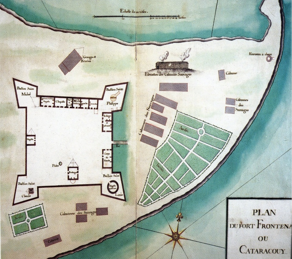
3) Fort Frontenac: French 1673 + “Cabanes des Sauvages”. French and Natives living in harmony.
4) Site of Sowards Coal. Industrial History. Contemporary Use: Site for Frontenac Village condo.
5) Site of Bootlegger’s District and business of famous bootlegger “Dollar Bill”. Contemporary Use: Food Basics store and parking lot.
6) Bajus Brewery. Industrial History: Brewery on site as early as 1794. Original wooden buildings replaced by stone 1835-1840. Jacob Bajus bought business in 1861. Iron stars on wall under kegs may represent “Twelve Star Lager”. Brewery ceased operations in 1922. Contemporary Use: Bajus Condominium and offices.
7) Davis Dry Dock. Industrial History: Established 1867. Commemorated by Sir John A. 1875. Expanded 1889 with construction of Welland Canal. Davis Dry Dock manufactured steam leisure yachts. Contemporary use: Dry Dock used by Metalcraft Marine.
8) Site of Canada Dredge and Dock Co. Industrial History: 1937-1973. WWII Ship Building in Inner Harbour. A quarter of work force teenagers as young as 13. Average age of teens 16, many with several dependents. Contemporary Use: Metalcraft Marine.
9) Metalcraft Marine. Site of boat building since1676. Contemporary Use: Industry founded in 1987. Niche market for custom aluminum fire and rescue boats. Customers throughout North America.
10) Kingston Marina. Industrial History and Contemporary Marina.
11) Queen City Oil Company Building (designated Heritage building) behind Rideaucrest. Industrial History: Built on or before 1908 for storage of Kerosene for Coal Oil lamps. Later owned by Standard Oil (S.O. = Esso) and Imperial Oil. Currently in disrepair. Projected Use: Cycle Rental.
12) Site of Anglin Lumber. Industrial History: Originally on both sides of Wellington north of Bay. Expanded south and west. Contemporary Use: Sites for OHIP building and part of Frontenac Village.
13) Site of Anglin Fuels. Industrial History. Contemporary Use: site of Leuwarden condo.
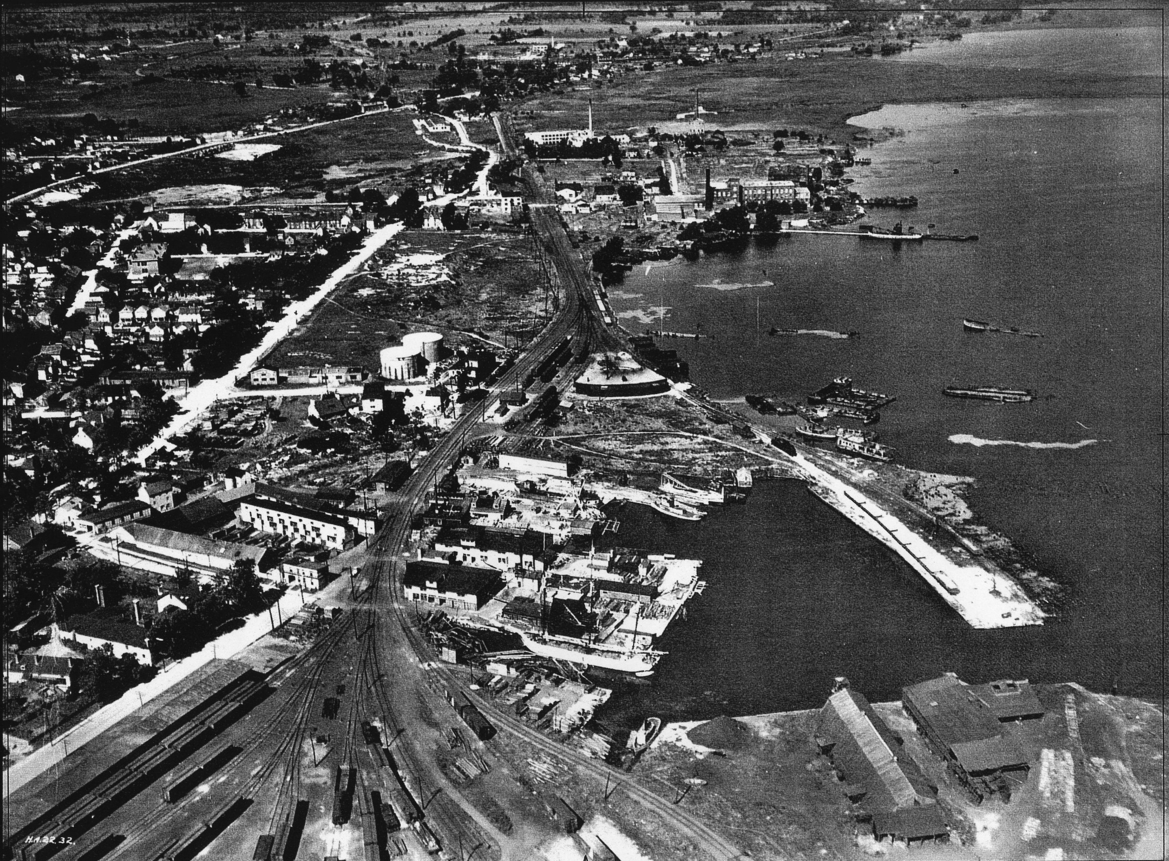 14) Site of the Grand Trunk Railway and later the K&P line. Grand Trunk came down Wellington St. and then angled SE and across a trestle bridge (remnants visible at end of peninsula that forms the eastern side of the Kingston Marina) to get to Ontario St. and the Inner Station which is now Frankie Pesto’s restaurant. Site of turnabout. Contemporary Use: Doug Fluhrer Park.
15) Sites of Molly and Joseph Brant’s houses behind Rideaucrest. Existing historical plaques.
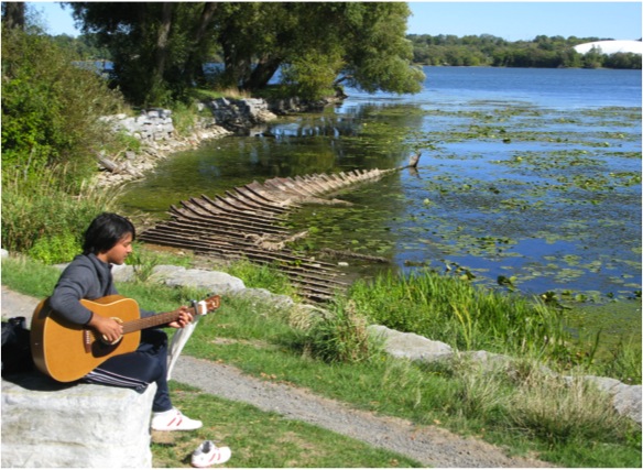
16)Wreck on shore near Woolen Mill. Industrial History: one of 14 wrecks in the Inner Harbour.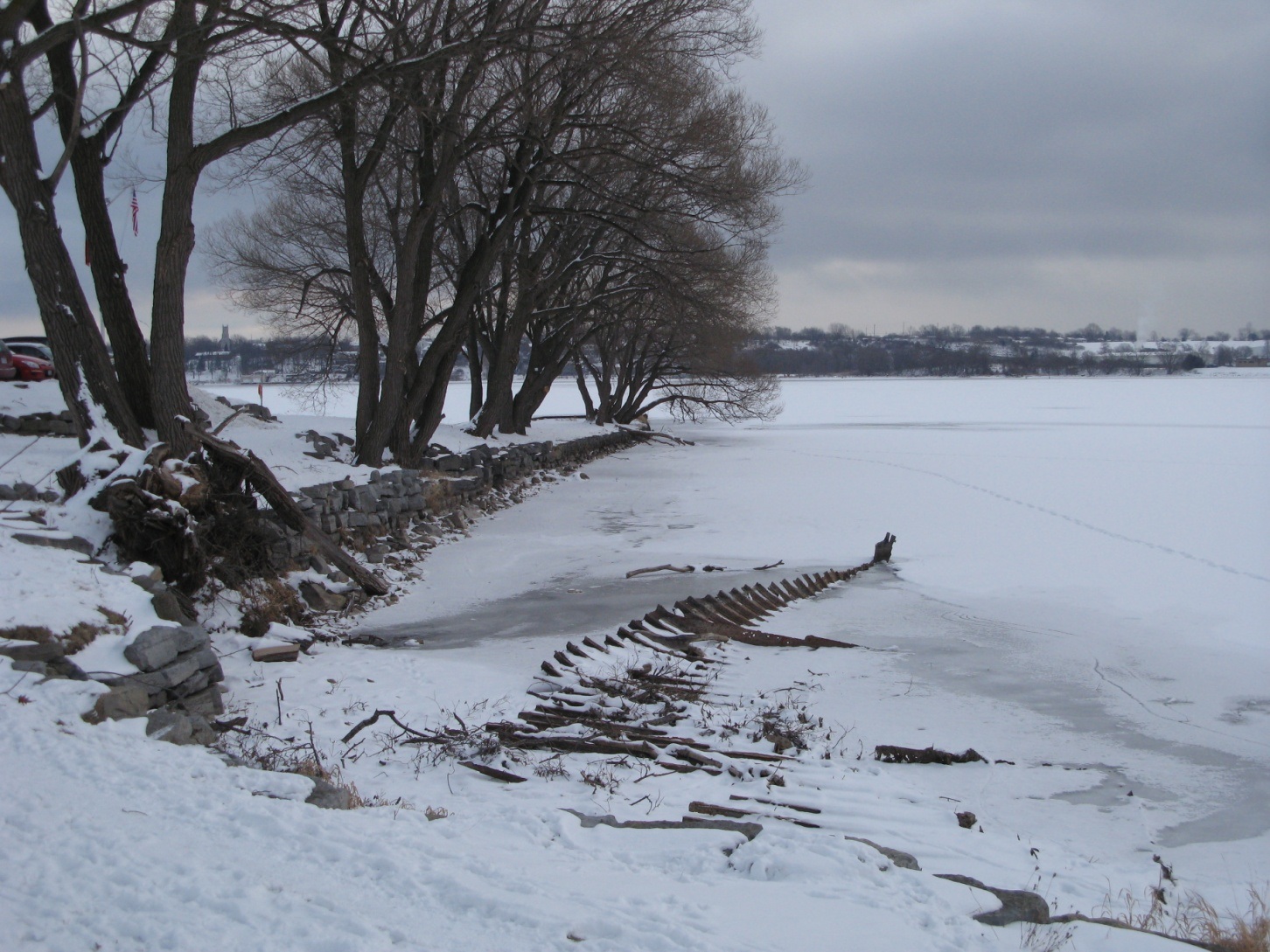 Unknown metal steamer probably propeller-driven. History of marine transportation in the Great Lakes and the abandoned boats left behind with improvements in the St. Lawrence waterway. “Urchins” from “Swamp Ward” encouraged to salvage wood despite fears wood harboured “Asian Cholera”.
17) Molly Brant Point Industrial History: Industrial site for over 130 years. Wharf of Woolen Mill. Two wrecks used to extend the point, placed prior to 1924. Also, remains of an elevated ore dock built in 1883 under the water south of Woolen Mill. For many years a demolition yard. Contemporary Use: Park
18) Woolen/Cotton Mill: Industrial History: Major employer in 1870s and 1880s. 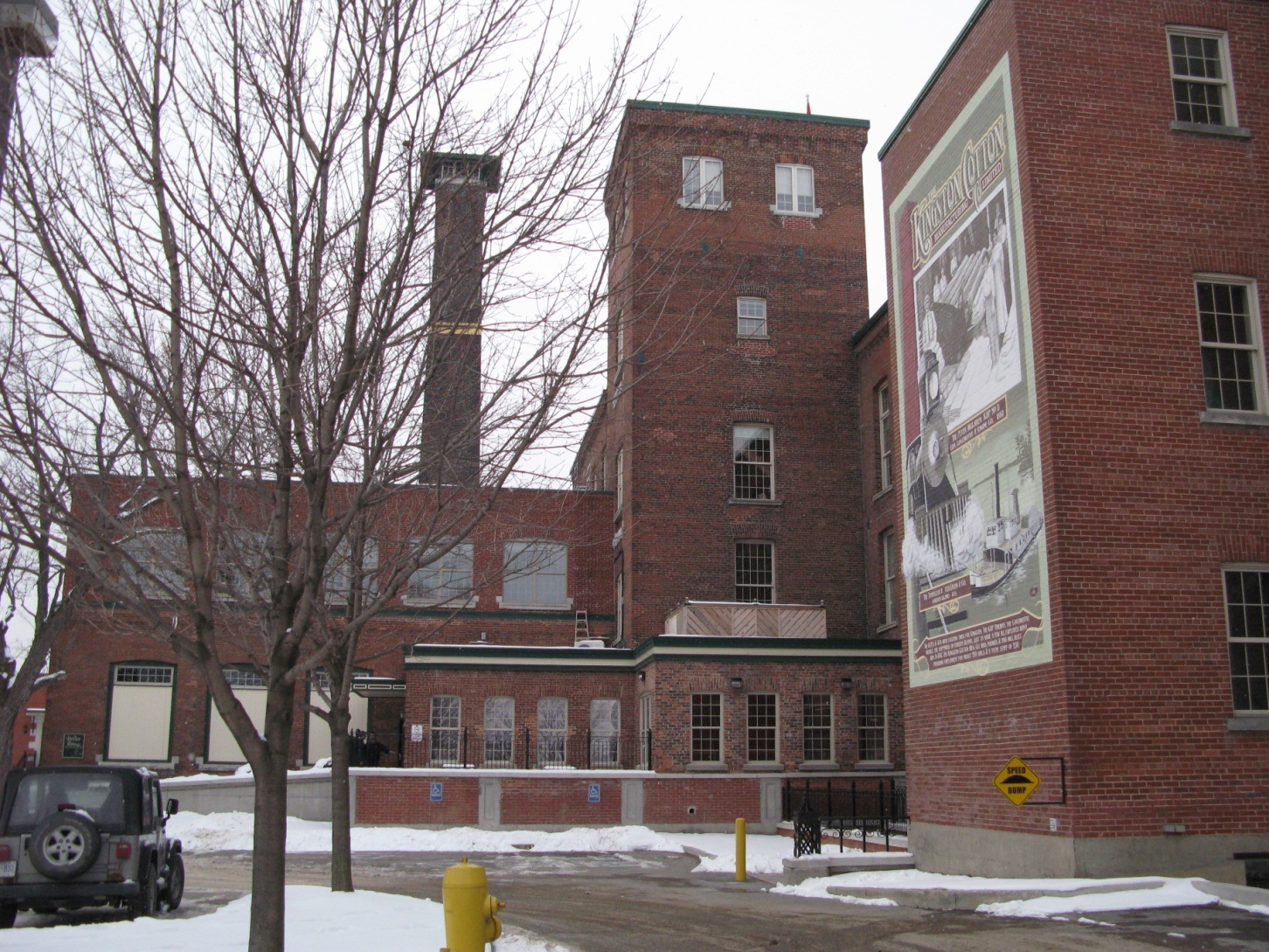 Example of Murmur Project story possibility re initiations: On first workday for new male employees, women held them down while oil was poured down their pants. Contemporary Use: Office Park with restaurants.
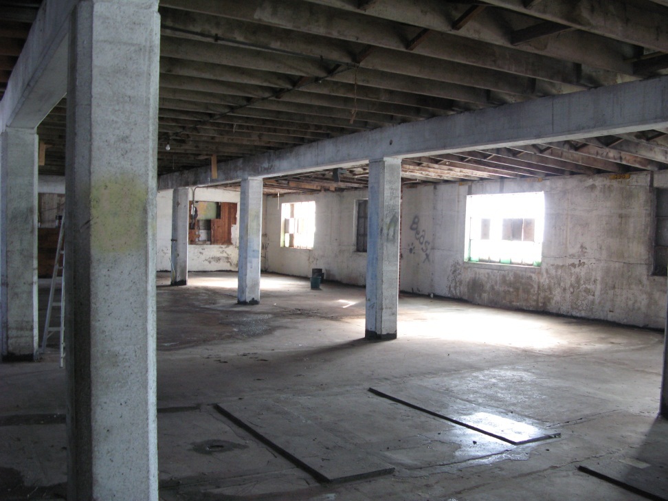 19) National Grocer Built 1930. Railway siding to loading dock. Food left out for urchins. Contemporary Use: Env. Friendly Building Materials. Artists Colony. Proposed rooftop restaurant.
20) Rowing Club built 1980 on land from the Buffalo Ontario Smelting Co.
21) Dye Chemical Co. Contemporary Industry
22) Site of Buffalo Ontario Smelting Co. Industrial History: lead smelting. Lead from Perth Road Village area mines.
23) Site of North American Smelting Co. Industrial History: lead, silver (from Cobalt, ON) and arsenic smelting.
24) Davis Tannery Industrial History. Established by Ford and son in 1860s. Later owned by Carrington and then Davis family. Site chosen for proximity to hemlock bark used in tanning and for good rail and water transportation facilities. Produced upper leather for footwear. One of largest tanneries in Canada. One of Kingston’s largest employers. Production ceased 1974. Main building demolished in 1983/4 for development not yet done. Chromium pollution and attempts at clean-up.
25) Berm at Orchard St. Marsh constructed as environmental clean-up (1970s) for Rowing Club.
26) Abandonned rail line to and from Belle Park. One of Kingston’s existing “Linear Parks”.
27) Belle Park Industrial History: Massive port development proposed by C.D. Howe in 1920s in conjunction with bid for large grain elevator. Contemporary story of dump and clean-up.
28/29) Belle Island Point Peninsula site (Middle Woodland, 1st c. A.D.) and Late Woodland burial site. Officially off limits for trail development but accessible for respectful walks.
30) Historical account of a Belle Island Recollet Mission from the time of Count Frontenac.
31) Kingston Outer Station Archaeological Site used by Natives for hunting and fishing.
32) CN Railway: Contemporary rail line.
33) Stories from the Swamp Ward and the Swamp: e.g. Oil- drenched cattails set on fire in play leading mistakenly to severe burns and marsh fires that were subsequently repeated over the years to the present.
34) The islands in the marsh just south of the 401 were lived on by the Conway brothers, trappers, who all died sad deaths.
 35) Maplehurst (1830): British (Early Canadian) History: The life and work of Thomas Burrowes, clerk of the lower section of the Rideau Canal. Engineer and artist. House build by prisoners. Six cells in basement. 115 historic watercolours in Ontario Archives. Projected Use: Museum
Information About The Trails:
2018
Download the MAAC Presentation about the North Crossing by clicking HERE.
2017
Work on creation of an accessible “North Crossing” for the K&P Trail
Although the City’s effort to connect the downtown to the Trans Canada Trail in time for Canada’s 150th birthday on July 1, 2017 was truly laudable, one section of the new trail remains problematic – the Division St. overpass at John Counter Blvd. It is not wheelchair accessible. As a result, the trail seems to be divided into two mutually exclusive sections.
In order to deal with this problem, we (Roger Healey and Mary Farrar) have discussed the problem with a number of councillors including Peter Stroud and Jeff McClaren (who originally put forward the motion to extend the K&P Trail) as well as local Councillor Rob Hutchison and new Councillor Gary Oosterhof who even came out one afternoon to ride the trail with us. Since then Councillor Mary Rita Holland has spoken with Commissioner Lanie Hurdle. This discussion led to an onsite meeting with Luke Follwell, Director of Recreation and Leisure, Councillor Mary Rita Holland, Roger Healey and Mary Farrar to determine the best alignment for a new pedestrian and cycling overpass east of the current road bridge. This new overpass will extend over both John Counter Blvd and the railway and will serve to connect the Rideau Heights and Kingscourt neighbourhoods as well as providing a safe mostly off-road trail connection to the downtown.
The City’s GIS department is working on an ownership map (Jan 2018). Roger and Mary will present their promotional PowerPoint to both the Municipal Accessibility Advisory Committee and the Environment, Infrastructure and Transportation Infrastructure Committee in Feb 2018.
Grand Opening of the K&P Trail, June 10
The City of Kingston organized a wonderful celebratory opening event for the opening of this multi-use trail that added 6.4 kms of trail to the existing K&P Trail. The trail now extends from the new downtown trailhead in Douglas R. Fluhrer Park to Binnington Court (the old trailhead) and from there it extends north to connect with the Trans Canada Trail in Sydenham. Most importantly Doug Knapp, who has been working hard on this trail for the last 25 years, was recognized for all of his hard work making this a reality The event, from 11 am – 4 pm, included an official ribbon cutting at 11 am by dignitaries including Mayor Bryan Paterson and Councillor Rob Hutchison. In addition, a park bench was dedicated to Doug Knapp and a K&P Ballad sung by Roger James! The weather was lovely and a good time was had by all in attendance.
2016
September 15th – Work to urban K&P Trail moves closer to downtown
The K&P Trail is moving closer to the downtown with work coming to the area around Doug Fluhrer Park and Molly Brant Point.
“You can start to ‘see’ the future trail alignment in the downtown area. Kingstonians are going to love using this trail when it’s complete. Trail users will be able to enjoy a natural experience in the heart of the urban Inner Harbour,” says Neal Unsworth, parks development manager. He says the clearing work consists of removing debris, vegetation and some trees to permit construction of the trail.
Crews continue to clear the sections of the trail between Hickson Avenue and River Street. Starting Friday, some mature trees in Doug Fluhrer Park and along the path by the Woolen Mill will be pruned. New trees of diverse and native species will be planted along the urban K&P Trail route once the trail work is completed.
TURTLES TO GET BASKING LOGS
The City is also being mindful of turtle habitats as work progresses: A recent investigation of turtle activity along the waterfront found hatched and predated eggs, but no live egg clutches.
Water work scheduled for next week includes the placement of basking logs for turtles. These logs will be placed in the bay at the north end of Doug Fluhrer Park and the south side of Molly Brant Point. The basking logs were specifically selected by an arborist and a biologist for this purpose and were taken from recently cleared sections of the trail. Once the basking logs are secured in place, the contractor will begin defining the trail alignment and grading.
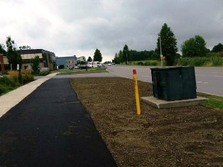
September – Update on the Urban K & P Trail:
On Road Sections:
The on-road (in the road allowance) sections of the K and P trail along Dalton Avenue and Cattail Place are paved with a 3m wide asphalt pathway and looking great!
Some new sidewalks on Rideau and River Street are being completed. Upgrades to a number of intersections (pavement markings across roads) will be done.
Off Road Sections:
The off road sections are also moving ahead. In the section between River Street and Hickson Ave Cruikshank Construction has begun clearing the trail route. An arborist and biologist have been assessing both bird nesting activity and tree stock prior to this initial trail clearing. No nests were found and significant groups of trees are being retained. There will be selective pruning up of the preserved trees to ensure safe passage of cyclists and pedestrians. The width of the tree clearing will extend beyond the footprint of the trail. Once this section is cleared, the trail area will be graded, and a base course of granular will be placed to provide a stable base for the 3m wide asphalt pathway.
The contractor will also be working on the east side of Rideau at Montreal to create a trail entry. This is a highly visible entry point to the trail and sight lines into this dense and overgrown area will be opened up to provide safer passage and comfort to the trail users. A secondary trail link will connect to Belle Park. The work will include clearing and grubbing of vegetation, the removal of garbage and debris, slope stabilization, native tree and shrub planting as well as the construction of the trail itself.
June
Trail construction connecting the K&P Trail from BInnington Court to the downtown began June 13, 2016 – connecting the Trans Canada Trail to downtown for July 1, 2017, Canada’s 150th birthday.
The work began behind the homes and businesses on Rideau Street (north of River Street /south of the Railway/Montreal intersection) as part of the Urban K & P Trail extension. Work included garbage and debris removal, clearing and grubbing and fill placement to stabilize the slope. According to Wikipedia grubbing means more than getting rid of grubs. It is “the removal of trees, shrubs, stumps and rubbish from the future right-of-way of a transportation corridor.”
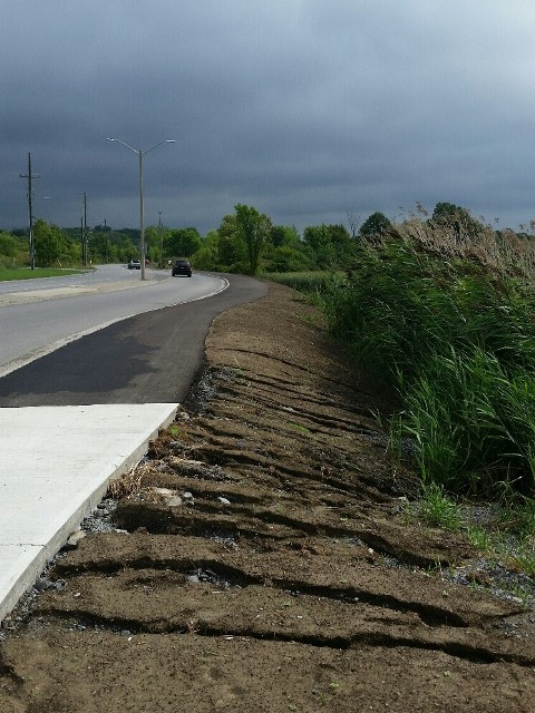
A huge swath of trees and shrubs has been cut down extending from the actual rail trail all the way to the backs of the buildings on RIdeau St. When I first saw it I was honestly heartbroken. What was the most beautiful cycling trail in the entire city now looks like a war zone. There are also mounds of earth being imported from the trail section on Dalton. They will be bulldozed into a slope so that the low cliff face on the west side of the trail will be covered and the ground will slope down to the trail. Evidently environmental restrictions prohibit retaining the old rail gravel and the entire surface will be covered before the 3m wide asphalt trail is completed. It will be planted with Native shade trees and shrubs.
For more information please see the July 2016 monthly update.
2015
2015 was an exciting year for our Inner Harbour Heritage Trail. It is now part of three trail projects: the K&P Trail, the Inner Harbour Heritage Tour, and the Waterfront Master Plan!
K&P Trail
Following a motion on May 19 by Councillors Peter Stroud and Jeff McLaren, city staff was directed to develop a route to extend the K&P Trail from its current trailhead at Binnington Court in the city’s north end to the downtown in time for Canada’s 150th birthday on July 1, 2017. This new extension of the K&P Trail will connect the TransCanada Trail to Kingston’s downtown and should be a major boon for cycle tourism. In addition, it should serve to increase off-road cycling options for all Kingston residents. MMM consultants were hired. They presented an initial plan to the Environment, Infrastructure and Transportation Policies committee and on December 1, 2015 a revised plan was unanimously endorsed by Council. Construction will take place this spring/summer/fall season (2016). The plan is available online.
The Inner Harbour section will go from the intersection of Montreal, Rideau and Railway Sts. on the old K&P pathway south of Belle Park to RIver Street., east on River St. to the water and then south around the Woolen Mill and through Douglas R. Fluhrer Park to the south end of the park. From there, signage will direct cyclists and pedestrians to proceed on existing roads to Confederation Basin. We are most grateful to Council and city staff for moving so quickly with this project. Our only remaining concern is for the safety and well-being of the endangered turtle species that are currently making a come-back in the park.
The Inner Harbour Heritage Tour
A tour extending from the Old Fort Frontenac to the Woolen Mill has also been created. We are most grateful to Laura Murray and her students for creating the Swamp Ward and Inner Harbour History Project (SWIHHP), for verifying and extending the tour originally created by Mary and Edward Farrar a few years ago, and for creating an app that will be available on the city’s webpage in due course. She will unveil this wonderful tour on the Jane’s Walk weekend – May 7-8, 2016. Check the calendar for details.
Kingston’s Waterfront Master Plan
Following two years of broad consultation with the public, Neal Unsworth and Kris Hebert of the City’s Parks Department, in consultation with ThincDesign, have completed a 705 page report examining all 280 kms of shoreline. A collection of over a hundred park projects is documented. Plans cover a 30 year time frame which prioritizes all of the projects in order of importance. A link on the City’s webpage will be available shortly.
The part of the K&P Trail being constructed in the summer of 2016 through Douglas R. Fluhrer Park is also considered to be part of the revisioning of the park, which in turn is considered one of the most important of the projects under consideration in the Master Plan. The consultants have done a lot of work. We are cautiously optimistic that this plan will not be left on the back burner as has happened so often in the past with city projects. It is critical that more money be made available on a regular basis for park and trail projects. We are also concerned at the lack of actual waterfront pathway connecting the various park projects in some coherent fashion. The next opportunity to create such a pathway will be in conjunction with the upcoming Active Transportation Master Plan consultations. Stay tuned.
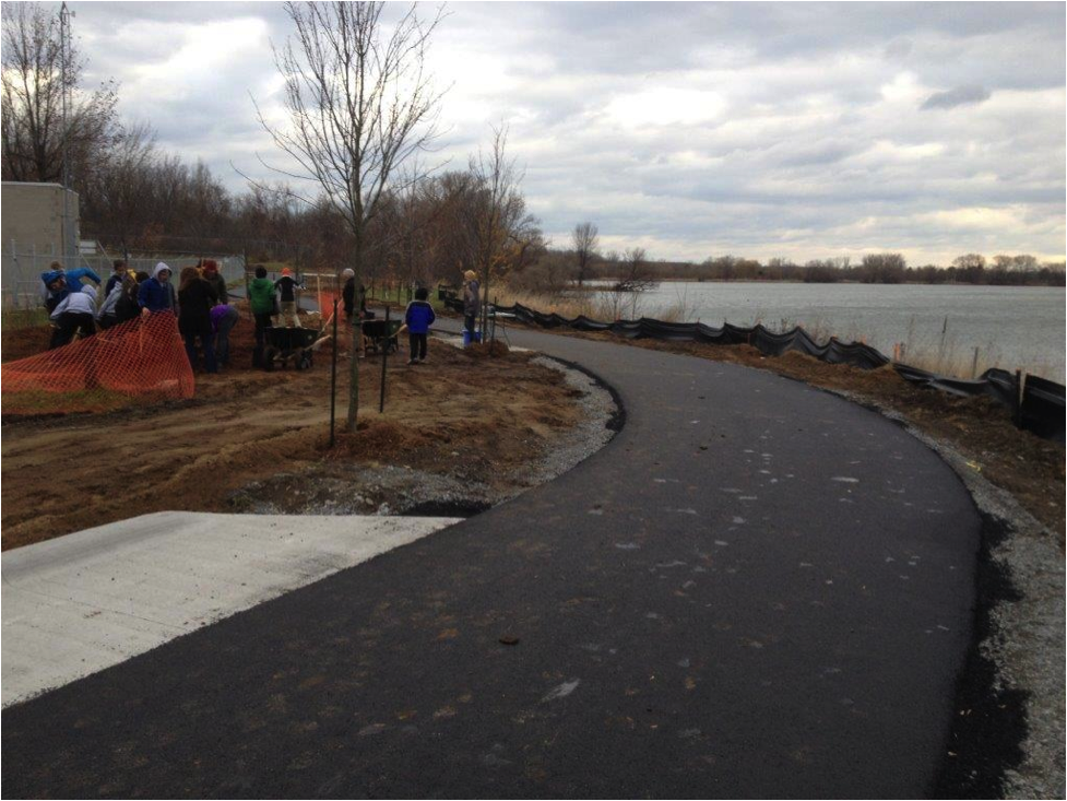 2013 Update
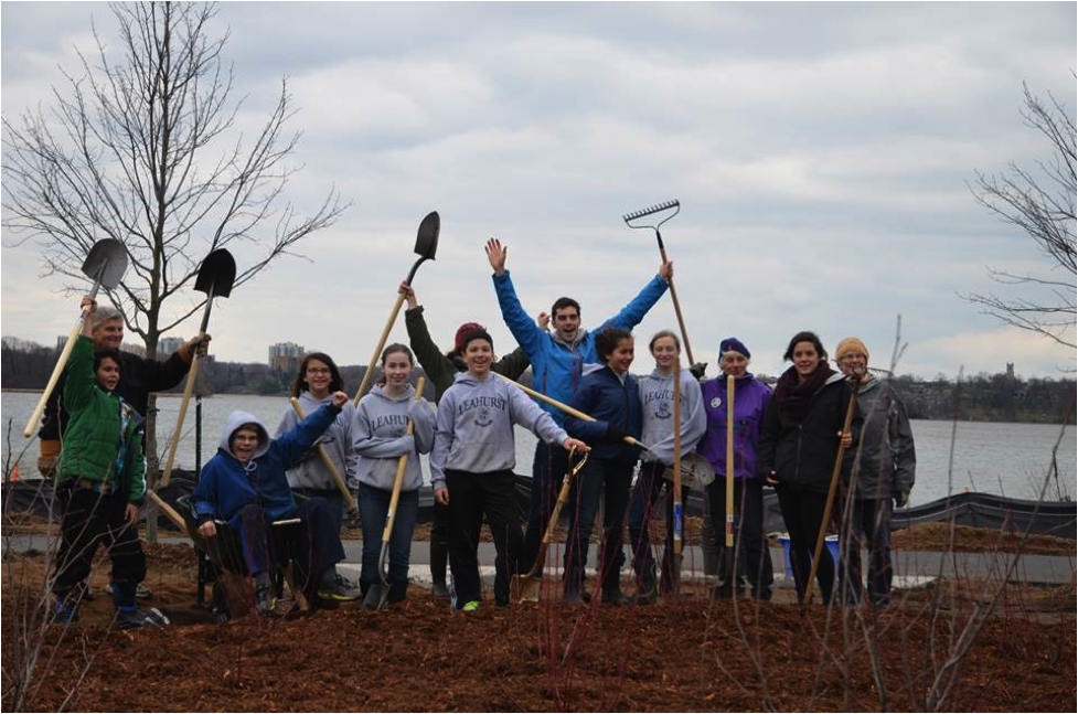
Construction began in November 2013 on the first small section of trail between the Kingston Rowing Club and River Street. We are so very grateful to the many community members who came together with students from Pathways to Education, Leahurst College and Parks Department staff to plant shrubs. We are also grateful to Mayor Mark Gerretsen for participating in the celebratory cake cutting, to Costco for providing the cake, to Joe Quattrocchi for providing apples for the hungry hoards, to the Main Street Market for coffee and to Don Campbell for the recorded musical accompaniment of Gene Autry singing “Happy Trails to You!” It was hard work but really fun.
The next section we hope to see completed in the spring of 2015 is the small bridge heading north from Belle Park to the Village on the River apartment complex that is just south of John Counter Blvd. Negotiations are currently underway.
The Inner Harbour Heritage Trail
The City of Kingston has pledged to fund creation of Stage One of the Inner Harbour Heritage Trail beginning in the spring of 2013 and extending over ten years. Stage One extends along the west side of the Great Cataraqui River from the La Salle Causeway in the south to Kingston Mills in the north. Currently in Stage One there exist small sections of an old trail that need to be integrated. Right now visitors can enjoy these portions along the waterfront at Douglas R. Fluhrer Park, around the woolen Mill, on the south side of Belle Park, and a paved section in front of the Village on the River apartment complex.
In 2011, a YouTube video was created exploring the initial trail vision. (See link above). Since that time, the trail vision has expanded to include a return to Kingston on the east side of the Great Cataraqui River along the shoreline and then down through the village of Barriefield. This trail will provide a beautiful, healthy and safe 20 km waterfront trail for residents and tourists alike. A trail like this has been a dream of interested citizens for as long as 30 years and we are grateful for the past vision of Phil Quattrocchi in particular. Now it can be a reality, making a new section of Kingston’s historic waterfront accessible so that both Kingstonians and tourists alike can experience Kingston as one of only a few places in the world that is both a UNESCO World Heritage site and connected to a UNESCO Biosphere – in this case, the Frontenac Arch Biosphere.
Background
In the spring and summer of 2010, new Kingston retirees Mary and Edward Farrar began exploring Kingston’s waterfront and developing a vision of a pedestrian and cycling trail that has now become known as the Inner Harbour Heritage Trail. Edward’s background as a professor of Geophysics and his interest in land forms and maps was a useful starting point. After City Council put forward a motion for City Staff to cost the project, a small working group was formed including Mary and Edward Farrar, Brian Osborne (Professor Emeritus of Geography), Robert Rittwage (Katarokwi Friendship Centre), Bob Tchegus (lawyer with an interest in trails) and Vikram Varma (Community Foundation for Kingston and Area), along with Kris Hebert, Lanie Hurdle and Neal Unsworth from City Staff. As City Staff began to embrace the idea of the trail vision and as the Farrars became more aware of the historical richness of the area, the trail vision expanded both in size and texture. It doubled in size to include the portion on the east side of the river and its possibilities as a heritage trail developed further to include celebrating aspects of Kingston’s Aboriginal, French, British, Industrial and Natural Heritage.
 A number of organizations have become supporters of the trail: environmental groups such as the Cataraqui Region Conservation Authority and the Kingston Environmental Advisory Forum (KEAF), neighbourhood associations such as the McBurney Park Neighbourhood Association, the Sydenham District Association, the Portsmouth District Association, the Williamsville District Association and the Katarakwi Friendship Centre, sports groups such as the Kingston Road Runners Association, the Kingston Velo Club, Cycle Kingston and Yellow Bike Action, trail associations such as the Rideau Trail Association, the K&P Trail group, healthy living groups such as the North of Princess Communities in Action as well as private land owners, interested individuals and politicians. City Council, MP Ted Hsu and MPP John Gerretsen have given the trail their unanimous support.
